Mt Adams Loop
A hiking app that knows exactly one trail — the 36-mile circumnavigation of Mount Adams — and nothing else. Fully offline.
Download on the App Store iOS 18 · watchOS 11 · no subscription
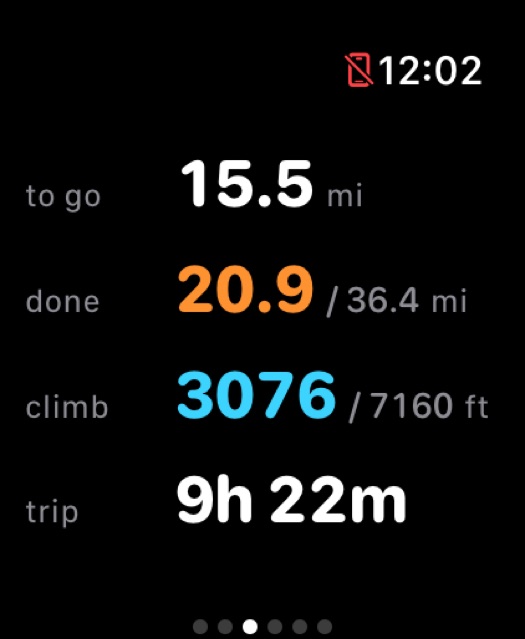
- Distance
- 36.37mi
- Ascent
- 7,160ft
- High point
- 8,268ft
- Off-trail section
- 3.7mi
- Marked points
- 30
- Water sources
- 9
Why
One trail, known properly
No single trail goes around Mount Adams. The loop links Round the Mountain #9, the Pacific Crest Trail and the Highline #114, and then on the east side runs out of trail altogether — roughly four miles of moraine, loose rock and glacier with nothing to follow. No general-purpose app has an opinion about that, because it has to hold every trail in the world and can afford to know none of them well.
So you walk with a map that shrugs, while the things you actually need — where the next water is, which fork to take, whether that creek is crossable — sit in a forum thread you read once, three weeks ago, at your desk.
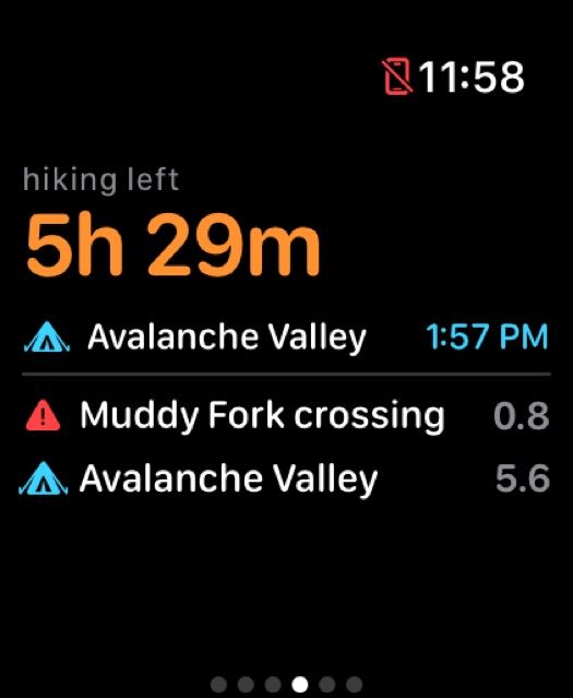
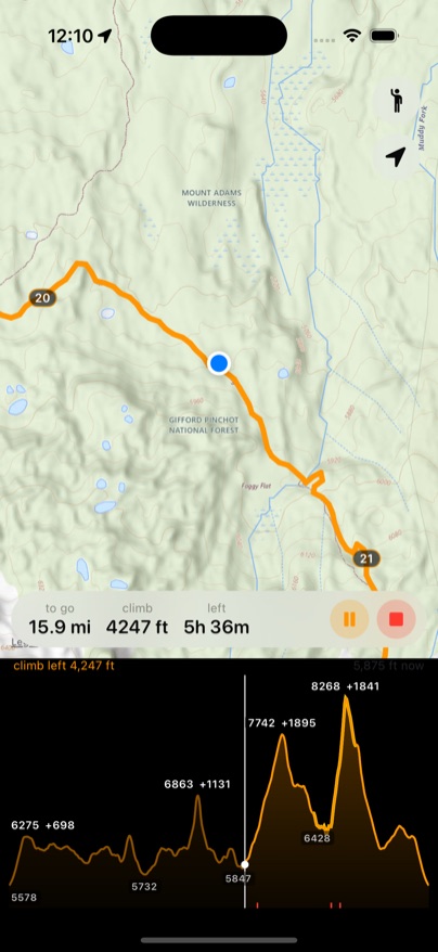
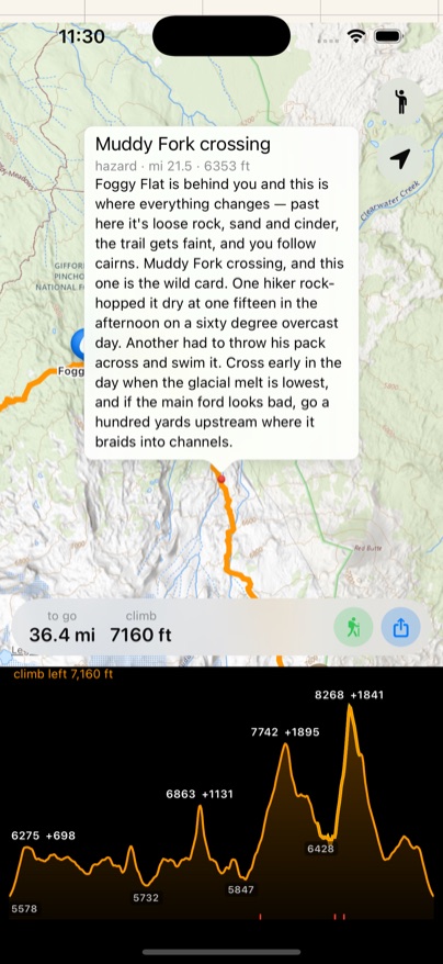
This app carries that thread with it. Thirty points along the route are marked — every water source, every legal camp, every creek crossing, the crux — and twenty-eight of them are annotated with beta pulled out of trip reports, which it says out loud as you reach them. You find out the Muddy Fork branches will clog your filter a mile before you need to have filled up, not while you're standing in one.
The whole map is already inside the app — every tile, at every zoom, for the entire loop. There is no download step at the trailhead, no account, no subscription and no premium tier holding the good layer hostage. Put the phone in airplane mode at the car and it behaves identically for four days.
On the wrist
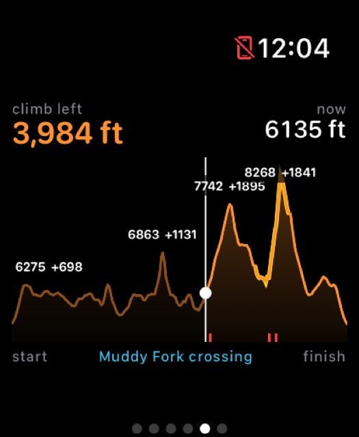
A real map on your wrist
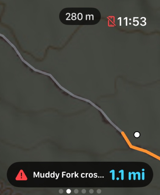
watchOS has no map view. None. So the map is drawn by hand, a pixel at a time — topo tiles, the route, your heading, the mile markers.
With your wrist down it drops the topo entirely and lights only the route line and your position on black. On an OLED panel power scales with lit pixels, and a glance at a junction doesn't need the contours.
Meeting points
For the place that isn't on any map
Drop a pin anywhere and give it a name — “second creek past camp”, “the boulder where we turn uphill” — and the app tells you when you arrive. It's the one kind of landmark no map ships with, because it only exists in a conversation your group had in a car park.
That was the original point, really. Parties split up: two people walk faster, somebody stops to filter water, somebody wants the viewpoint. Agreeing on a spot is easy. Recognising it eight hours later, from the other direction, in cloud, is not — so the pin does the recognising, and everyone's phone counts down to the same place.
The beta
Trip reports, pinned where they happened
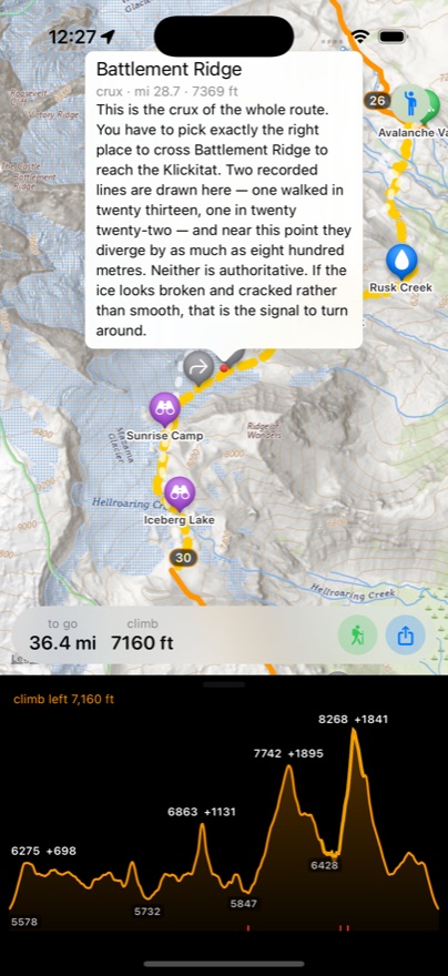
Tap a point and you get what people who've walked it actually said. Colour and glyph carry the category, so the map answers "what is that" before you touch anything: blue for water, green for camps, red for the two hazards and the crux, purple for the viewpoints.
Backstory
A mountain with a complicated deed
Adams is bigger than it looks from the road — the second-largest volcano in the Cascades by volume, behind only Shasta, with twelve named glaciers and nine square miles of ice. It last erupted about a thousand years ago, which makes it dormant rather than extinct. Even the name is a clerical error: Hall J. Kelley campaigned in the 1830s to have the Cascades renamed after presidents, and the mapmaker Thomas Farnham put “Adams” some forty miles off target, where by luck there happened to be a very large mountain.
The east side of it isn't public land. It was meant to sit inside the reservation drawn by the Treaty of 1855, but a misfiled map and a careless survey handed it to the federal government instead. The correct map surfaced in 1930; it took another forty-two years to act on. On 20 May 1972, Executive Order 11670 returned 21,000 acres of the mountain's eastern slopes to the Yakama Nation. So the loop is only walkable for the few weeks a year the Nation opens Tract D, on terms set annually — anything you read online about dates and fees, this page included, should be assumed out of date. Yakama tribal forestry is the only current source, and they answer the phone.
The hardest ground on the loop is named after the first man across it. Battlement Ridge, and the Rusk Glacier beneath it, take their names from Claude Ewing Rusk, a Yakima lawyer who forced a route up the east face in 1921 and wrote it up in Tales of a Western Mountaineer. Eight years later a White Salmon man named Wade Dean staked a sulfur claim on the summit itself — one of the highest mining claims in the country, worked by mules to Crescent Glacier and sleds above it, with a cabin at 12,281 feet, and abandoned with almost nothing to show for it in 1959.
The Gap
Four miles where the map runs out
Between Avalanche Valley and Sunrise Camp there is no trail — only where other people happened to walk. It is the reason most people who set out to circle this mountain don't finish the circle.
Two lines, and neither of them is the truth
Two recorded traversals walked nine years apart agree to a 30 metre median, and diverge most exactly where the trip reports say the boot path disappears. A third published line disagrees with both by up to 800 metres near Battlement Ridge.
So the app draws both, dashed, and says out loud that neither is authoritative. A single confident line through that terrain would be a lie told at the worst possible moment.
Colophon
- Route
- 2,053 points, OSM geometry solved with Dijkstra
- Elevation
- USGS 10 m DEM, noise-thresholded
- Basemap
- USGS National Map, z11–17, bundled
- Watch map
- SwiftUI Canvas — watchOS has no MapKit view
- Recording
- HealthKit workout with route, syncs onward to Strava
- Verification
- Headless replay of all 36 miles, about a second
Further reading
- Trail #9, Round-the-MountainUS Forest Service
- Tract D — access and permitsYakama Nation
- Executive Order 11670, 1972HistoryLink
- Claude Ewing RuskThe east face, 1921
- Mount Adams Loop HikeOregon Hikers field guide
- Navigating the GapKirsten Anderson
- Round the MountainWashington Trails Association
- Around Mt Adams — 5h37mFastest Known Time
Built in a few days for a hike leaving in three — Mount Adams, Washington